TGS Launches Two Regional Seismic Products for Alaska's North Slope
Image
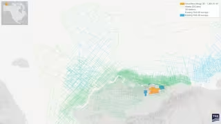
Oslo – October 11, 2026 -- TGS has launched two regional seismic products for Alaska, including a 2D-cubed volume that integrates roughly 667,640 square kilometers of data across the North Slope, Beaufort Sea and Chukchi Sea.
Great Bear Merge 3D stitches legacy surveys across 1,366 square miles
The Great Bear Merge 3D project combines multiple legacy seismic surveys into a single regional dataset covering approximately 1,366 square miles of Alaska's North Slope. TGS reprocessed the data with modern imaging technologies, including full-waveform inversion (FWI). The company says this improves data quality and continuity across historical survey boundaries.
The result is a consistent regional framework for evaluating exploration and development opportunities.