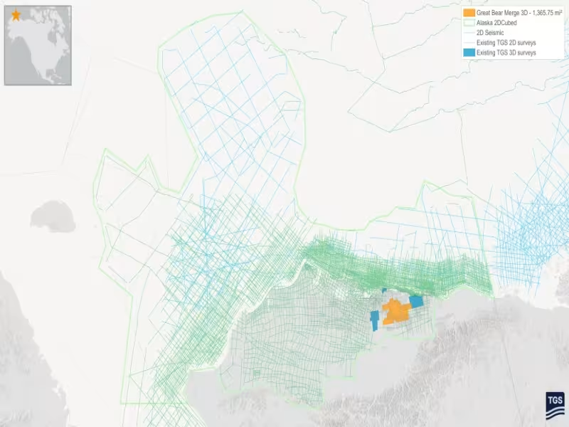
Oslo – October 11, 2026 -- TGS has launched two regional seismic products for Alaska, including a 2D-cubed volume that integrates roughly 667,640 square kilometers of data across the North Slope, Beaufort Sea and Chukchi Sea.
Great Bear Merge 3D stitches legacy surveys across 1,366 square miles
The Great Bear Merge 3D project combines multiple legacy seismic surveys into a single regional dataset covering approximately 1,366 square miles of Alaska's North Slope. TGS reprocessed the data with modern imaging technologies, including full-waveform inversion (FWI). The company says this improves data quality and continuity across historical survey boundaries.
The result is a consistent regional framework for evaluating exploration and development opportunities.
Alaska Regional 2D-Cubed links onshore plays to offshore discoveries
The Alaska Regional 2D-Cubed project merges legacy 2D and 3D seismic data through a unified processing and imaging workflow. The output is a single, regionally consistent interpretation volume spanning the North Slope, Beaufort Sea and Chukchi Sea.
TGS says the continuous subsurface framework enables basin-scale screening of remaining onshore recoverable reserves. It also targets additional opportunities in the Beaufort Sea and, in particular, the Chukchi Sea. There, the framework connects multiple offshore oil discoveries to the commercially successful Permian-Cretaceous stacked plays onshore.
TGS targets acreage evaluation and prospect identification
The two products are designed to support acreage evaluation, prospect identification and strategic decision-making across Alaska's onshore and offshore basins.
David Hajovsky, EVP of Multi-Client at TGS, said customers increasingly want a regional perspective that extends beyond individual surveys, as industry interest grows across the state's basins.
TGS says it maintains one of the industry's most extensive seismic data portfolios in Alaska.